
Describing transit systems using GTFS data in Python
After learning R during the spring semester (and tinkering with this site), I was eager to expand my programming knowledge, which led me to GEOG 6180 Geoprocessing with Python. The course had three main objectives:
- Learn fundamental principles of programming in Python
- Use Python to manipulate and analyze geographic data
- Write scripts for geoprocessing in Python and ArcGIS
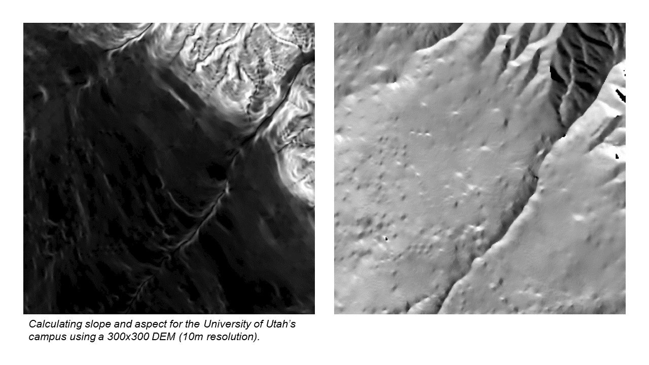
I learned the basics of Python and arcpy during the first few weeks of the semester before moving onto “classic” spatial analyses, such as calculating the optimal location for a site based on the minimum weighted travel distance or determining slope and aspect from a digital elevation model, or DEM. These assignments focused on the theory and structure behind each type of analysis and used simple inputs to illustrate the basic process.
For my semester project, I decided to write a script to process General Transit Feed Specification data. GTFS is a standard text-based data format used by thousands of transit agencies worldwide to share operational data, including routes, schedules, live tracking, and more. A few months ago, I had seen two intriguing fellowships with the USDOT Bureau of Transportation Statistics that involved handling GTFS data, and I thought this would be the perfect opportunity to gain some firsthand experience.
I used Jupyter to write separate notebok scripts to describe a single bus system and compare two bus systems, which used the gtfs_functions package to handle the initial data processing, geopandas and pandas for data analysis, and keplergl for map visualizations. I won’t go into detail on the process since the notebooks include some commentary, but it was a great learning experience and now I have a script that can theoretically take any GTFS feed and spit out some basic statistics and maps.
I have a much stronger grasp of the basic fundamentals of programming after taking this course. Even though I had written plenty of R code during the spring, I was primarily focused on cleaning and analyzing specific datasets in a linear, step-by-step process. This course introduced functions, for loops, if/elif/else statements, and other statements or methods that will help me write more advanced scripts. Plus, knowing the basics of arcpy will be a gamechanger as I work more in ArcGIS Pro. I’m excited to keep expanding my expertise in Python, especially as I begin thinking about what my early career could look like.